Why NepalPick recommends it
Why Rukumkot & Sisne rewards curiosity
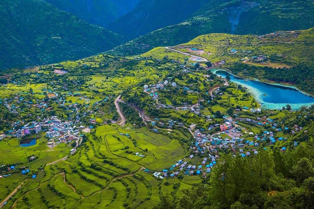
Discover Rukumkot’s valley, Kamal Daha, village trails, and views toward the Sisne Himal in a region still well outside mainstream itineraries.
The journey offers space to notice how the landscape changes, eat what is seasonal, and let local knowledge shape the day. The point is not to collect sights. It is to understand why this place feels different from Nepal’s familiar routes.
Tourism services are emerging, confirm transport and accommodation in advance.
Complete planning guide
Planning Rukumkot & Sisne: itinerary, logistics, weather, and costs
Research-based framework, last reviewed 14 July 2026. Operational details — roads, flights, lodges, permits, fees — change; items marked for verification must be reconfirmed before booking.
Recommended6 days5–7 days once in eastern Rukum; add 1–2 travel days each way
Start / endKathmandu/Pokhara → (road, or fly toward mid-west hubs) → Rukumkot → return
Highest pointRidge viewpoints toward Sisne, approximately 3,000–3,500 m (Sisne itself is a mountaineering objective, not included)
Trip stylenature escapeFlexible, self-sufficient travellers comfortable being the only visitors; moderate walking, emerging services.
Eastern Rukum's lake-and-ridge country: Rukumkot village above Kamal Daha's lotus lake, Kham Magar culture, and walking toward honest viewpoints of Sisne Himal — the peak that anchors the skyline of a district still writing its tourism story. Go curious, plan loose.
Getting there: preferred and alternative routes
PreferredKathmandu/Pokhara → Rukumkot by road
Road (highway to mid-west, then local roads) · 12–16 hours, split over two days · overnight: Highway town midway (e.g., Dang side)
- Works because
- The dependable option; scenery compounds westward
- Trade-off
- Long
- Vulnerable to
- Rural final sections degrade with rain
- Book
- Agency vehicle or staged buses
- Reconfirm locally
- Final-section road status via local contacts — this decides everything
AlternativeFly toward a mid-west airstrip then road
Flight + road · Saves a highway day when schedules align
- Works because
- Less road
- Trade-off
- Thin, changeable flight schedules
- Vulnerable to
- Cancellation-prone routes
- Book
- Verify schedules exist before building the plan on them
- Reconfirm locally
- Whether the relevant airstrip has current scheduled service — do not assume
No flight, road, bridge, or lodge on this page is promised to operate on a given day — that is Nepal, honestly stated. Build the margins this page recommends.
Day by day
Day 1Arrive RukumkotFinal road hours + settling
Morning: Complete the approach through Rukum's gorges.
Route and pace: Arrival day; short lakeside leg-stretch.
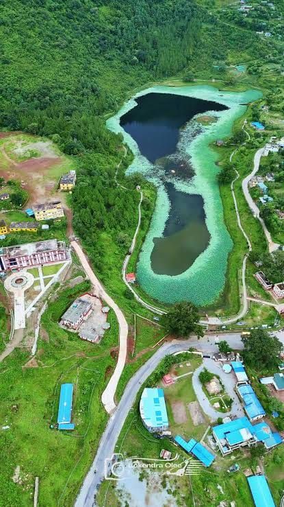
The experience: Kamal Daha's lotus lake below the old village — the postcard that never got printed.
Overnight and meals: Local lodge or homestay, arranged ahead.
Key risk / decision: Accommodation is small-scale — arriving unannounced tests goodwill.
Fallback: Musikot (district HQ) backstops lodging.
Day 2Kamal Daha + Rukumkot heritage circuit4–5 hours walking
Morning: Lake circuit in lotus season, then the village's old quarters.
Route and pace: Gentle, social.
The experience: The '52 lakes and 53 hills' district told through its centrepiece; local history includes the conflict years — listen more than ask.
Overnight and meals: Rukumkot.
Key risk / decision: —
Fallback: —
Day 3Village trails into Kham Magar country5–7 hours walking
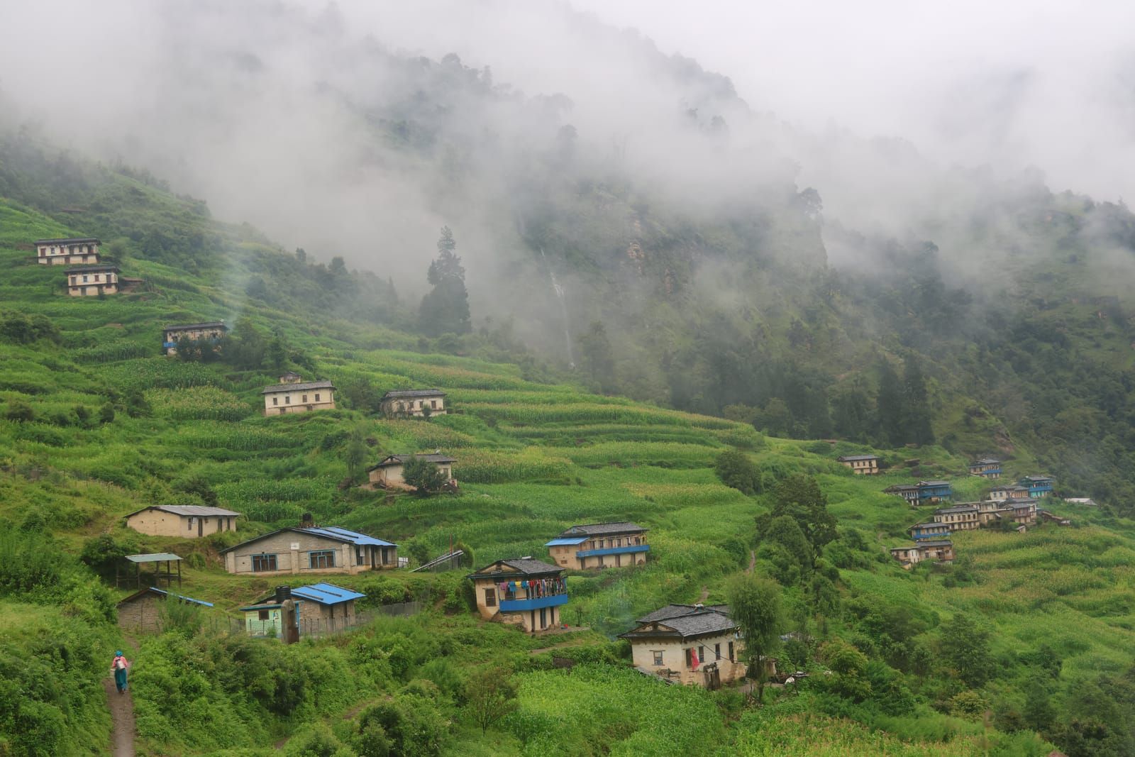
Morning: Walk out through terraced settlements with a local guide.
Route and pace: Farm-trail rhythm.
The experience: Kham Magar language, weaving, and hospitality — distinct, proud, and rarely visited.
Overnight and meals: Village homestay where arranged, else return.
Water: Treat everything.
Key risk / decision: Trails are local-knowledge terrain.
Fallback: Shorter loops exist in every direction.
Day 4Ridge day toward Sisne viewpoints6–8 hours walking · to approx. 3,000–3,500 m
Morning: Early climb to a guide-chosen ridge line.
Route and pace: Sustained but non-technical.
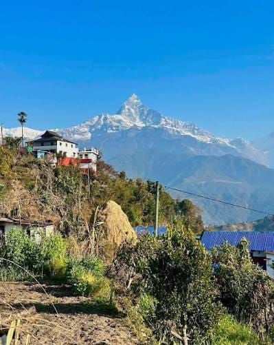
The experience: Sisne Himal's pyramid across the middle hills — the honest version of 'seeing Sisne' (the base camp is an expedition, not a stroll).
Overnight and meals: Rukumkot or high village.
Key risk / decision: Weather exposure; navigation without a guide is genuinely unwise.
Fallback: Lower viewpoint loop in cloud.
Day 5Flex day: second ridge, market, or lake dawnBy choice
Morning: The district rewards an unplanned day more than most.
Route and pace: —
The experience: Whatever day four revealed you wanted more of.
Overnight and meals: Rukumkot.
Key risk / decision: —
Fallback: This is also the built-in contingency slot.
Day 6Depart (toward Musikot or the highway)Road day
Morning: Begin the long unwinding east or south.
Route and pace: —
The experience: The hills releasing slowly.
Overnight and meals: Highway town or onward.
Key risk / decision: Same rural-road caveats.
Fallback: Split freely; nothing downstream is tight.
Weather through the year
| Season | Typical character | Trails, roads, lodges, flights | Think twice if |
|---|
| Mar–May | Warm days, green terraces, haze building; ridge mornings clear early. | Roads at their pre-monsoon best. | Nobody. |
| Jun–Aug | Monsoon: lush, wet, roads suffering; lotus season on Kamal Daha peaks mid-monsoon — a genuine draw with real access costs. | Final road sections unreliable. | Anyone inflexible; lotus-seekers accept the gamble knowingly. |
| Sep–Nov | Clear, stable, harvest-gold terraces; Sisne sharpest. | Best window all-round. | Nobody. |
| Dec–Feb | Cold nights, crisp days; snow on high ridges limits viewpoint options. | Roads workable; homestays cold. | Cold-averse sleepers. |
Seasonal patterns, not forecasts. Temperatures vary dramatically with altitude on the same day — pack by elevation range.
Things to do
- Kamal Daha lotus lake (bloom peaks mid-monsoon)
- Rukumkot old village and its layered history
- Kham Magar village walks and weaving
- Ridge viewpoints toward Sisne Himal
- Being early: watching a destination invent its welcome
On the ground
Accommodation
Small local lodges and emerging homestays; Musikot backstops with basic hotels. Everything improves with advance arrangement through local contacts.
Food and water
Home-style dal bhat and whatever the season grows. Treat all water.
Connectivity and power
Town-adjacent signal, gaps beyond; grid power with outages. Modest self-sufficiency advised.
Cash and payments
Cash entirely; supply in Musikot at the latest.
Permits and guide requirements
| Requirement | Amount | Authority | Note |
|---|
| None currently required | — | — | No park or restricted area on this itinerary; verify nothing has changed via your local contact — the district's status could evolve with tourism. |
Guide requirement: A local guide is functionally essential for ridge routes and village introductions, and locating one is itself the planning task — work through a mid-west-experienced agency or district contacts ahead of travel.
What it costs
| Band | USD (per person) | NPR (approx.) | What it buys |
|---|
| Budget local-service | USD 450–650 | NPR 69,000–NPR 100,000 | Staged buses, homestays, local guide days. |
| Recommended guided | USD 650–900 | NPR 100,000–NPR 138,000 | Dedicated vehicle, arranged homestay chain, guide throughout. |
Main cost drivers
- Long road access
- Vehicle charter
- Guide and homestay arrangement
Typically included
- Transport
- Lodging and meals
- Guide
Not included
- International airfare, visa, insurance
- Tips
Contingency: 15% — informality is the price of earliness.
Planning ranges per adult, twin-share, for the recommended duration from the stated gateway — not quotes. NPR conversion uses the Nepal Rastra Bank selling rate of USD 1 = NPR 153.3 reviewed 31 August 2026, rounded to the nearest NPR 1,000; bank, card, and cash rates differ. Excludes international airfare, visa, insurance, tips, and personal spending unless stated.
Packing essentials for this route
- Sleeping layer for cold homestay nights
- Full rain kit outside winter
- Water treatment
- Torch, power bank
- Patience as equipment
Safety and contingency
- Ridge days approach altitude-lite (3,500 m) — hydrate and pace, no acclimatisation needed at these sleeping heights.
- Rural roads: daylight travel, good drivers, loose schedules.
- Medical facilities are distant — carry a real first-aid kit and evacuation-capable insurance.
- Treat water.
If things change: Day 5 is the designed buffer. If final roads fail entirely, Musikot-based day loops salvage culture and viewpoints — arrange that fallback mentally before departure.
Accessibility
Not realistically accessible below full mobility: road roughness and trail terrain compound. Kamal Daha itself is vehicle-adjacent when roads cooperate.
Travelling responsibly here
- The conflict era touched this district deeply — receive stories; don't extract them.
- Kham Magar culture is not a photo set: consent, names, reciprocity.
- Pay homestays properly; you are setting precedents.
- Pack out all non-organics — no waste chain exists.
- Sisne's slopes are for equipped expeditions; don't let summit-adjacent bravado outrun the itinerary.
Booking checklist
- Establish a local contact/guide before travelling
- Verify final road status days ahead
- Pre-arrange homestays
- Carry full cash from the highway
- Check any flight-assisted routing actually operates
- Insurance with road-evacuation reality in mind
Sources
Research draws on the following, alongside NepalPick’s editorial method. Last reviewed 14 July 2026; recheck official sources on the day you book.