Why NepalPick recommends it
Why Narchyang & Mohare Danda rewards curiosity
Combine village life in Narchyang with a community managed ridge trek offering close views of Dhaulagiri and Annapurna away from the busiest routes.
The journey offers space to notice how the landscape changes, eat what is seasonal, and let local knowledge shape the day. The point is not to collect sights. It is to understand why this place feels different from Nepal’s familiar routes.
Stay in community lodges and ask before photographing people or ceremonies.
Complete planning guide
Planning Narchyang & Mohare Danda: itinerary, logistics, weather, and costs
Research-based framework, last reviewed 14 July 2026. Operational details — roads, flights, lodges, permits, fees — change; items marked for verification must be reconfirmed before booking.
Recommended6 days5–7 days from Pokhara
Start / endPokhara → Beni → Narchyang → community-lodge ridge → Tikot-side descent → Pokhara
Highest pointMohare Danda, approximately 3,300 m
Trip stylecommunity journeyModerately fit walkers; a model introduction to Nepali trekking with community lodges instead of commercial teahouses.
The community-lodge route: Narchyang's waterfalls and Magar village life below Annapurna South, then the locally built and locally owned lodge chain through Nangi to the Mohare Danda ridge — a Dhaulagiri-to-Annapurna sunrise earned on trails the villages themselves maintain.
Getting there: preferred and alternative routes
PreferredPokhara → Beni → Narchyang
Road · 3–5 hours
- Works because
- Short, simple staging from Pokhara
- Trade-off
- Rough final section into Narchyang
- Vulnerable to
- Kali Gandaki road slides in monsoon
- Book
- Local jeep/bus same-week
- Reconfirm locally
- Road condition past Beni and lodge bookings via the community network
AlternativeStart from Galeshwor side (Banskharka entry)
Road + trail · Similar
- Works because
- Classic community-trail entry via orange-farming Banskharka
- Trade-off
- Skips Narchyang's waterfalls unless looped
- Vulnerable to
- Same corridor
- Book
- Same-week
- Reconfirm locally
- Which entry the community coordinator recommends for your dates
No flight, road, bridge, or lodge on this page is promised to operate on a given day — that is Nepal, honestly stated. Build the margins this page recommends.
Day by day
Day 1Pokhara → Narchyang3–5 hours road + village walk
Morning: Drive up the Kali Gandaki past Beni.
Route and pace: Afternoon settling into the village.
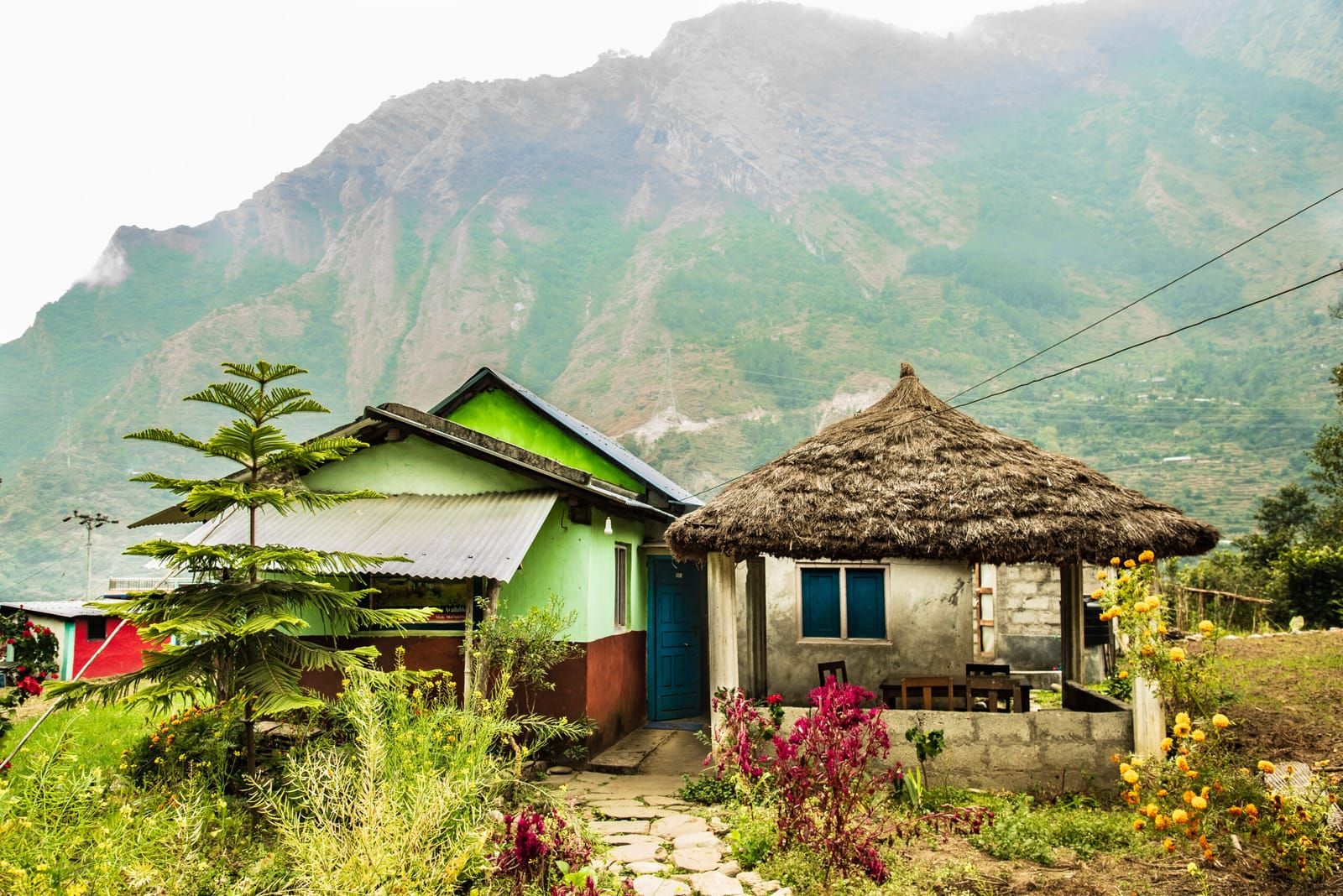
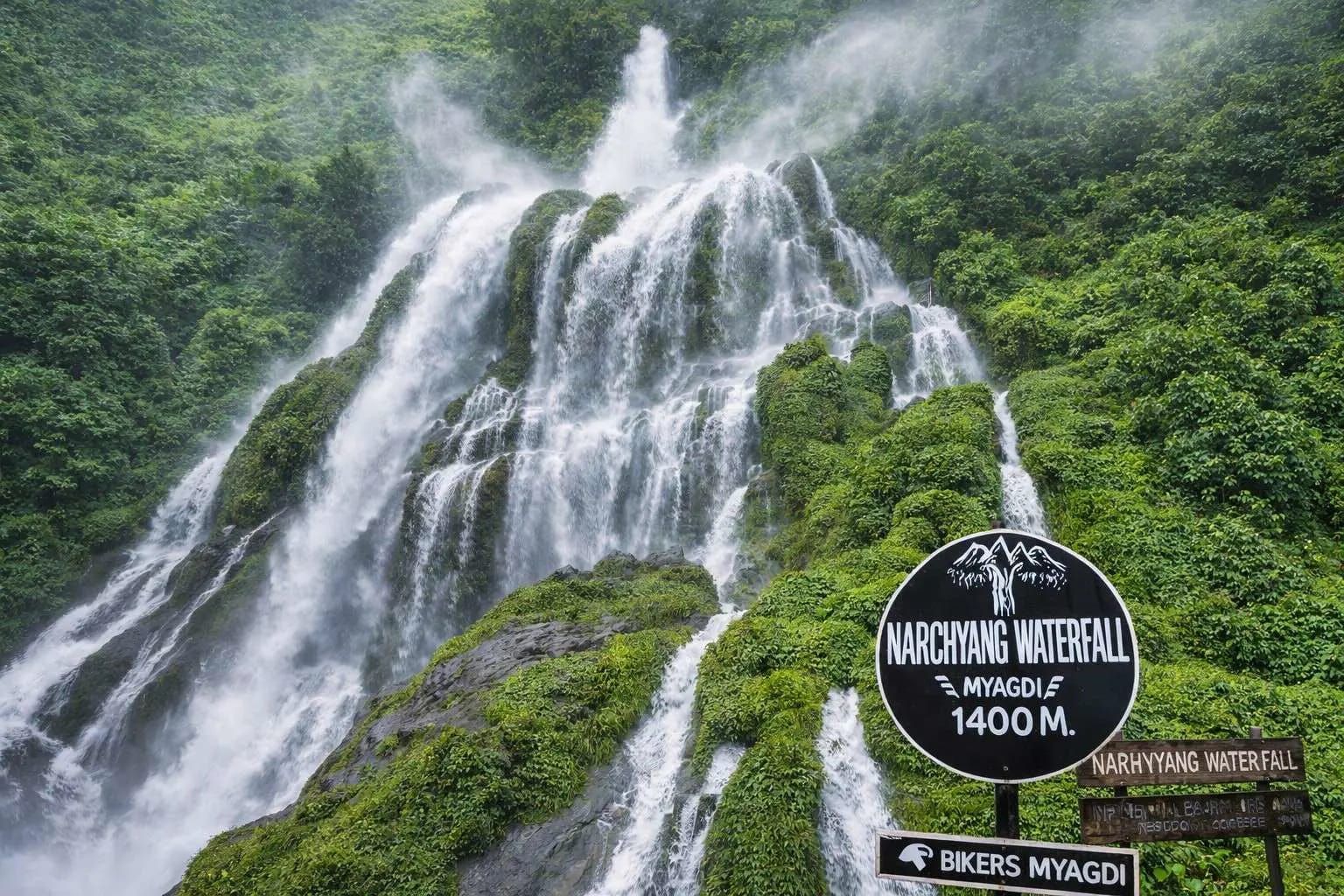
The experience: Narchyang's Magar community, mill-races, and the roar of waterfalls off Annapurna's flank.
Overnight and meals: Community homestay/lodge, Narchyang.
Key risk / decision: None significant.
Fallback: Beni overnight if roads crawl.
Day 2Narchyang waterfalls + village day3–5 hours walking
Morning: Waterfall circuit walk with a local guide.
Route and pace: Gentle; the day is social as much as scenic.
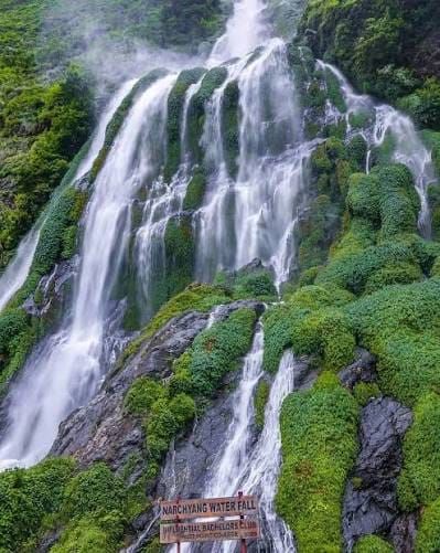
The experience: Seven-falls viewpoints, fish ponds, school visits if welcomed — village economy up close.
Overnight and meals: Narchyang again.
Key risk / decision: Spray-slick steps near the falls.
Fallback: —
Day 3Narchyang → Nangi5–7 hours walking · approx. 2,300 m
Morning: Climb through terraces and community forest.
Route and pace: Sustained but sociable ascent.
The experience: Nangi — the route's famous village: community lodge, school, paper-making, and the ridge network's home base.
Overnight and meals: Nangi community lodge; income funds the school.
Water: Village taps; treat.
Key risk / decision: Sun on open terraces — start early.
Fallback: Banskharka overnight splits the climb on the Galeshwor variant.
Day 4Nangi → Mohare Danda4–6 hours walking · approx. 3,300 m
Morning: Ridge climb through rhododendron and oak.
Route and pace: Steady; the lodge appears exactly when wanted.
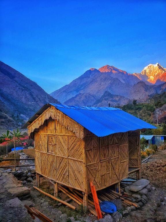
The experience: Mohare's summit lodge — sunset over Dhaulagiri I with tomorrow's promise behind it.
Overnight and meals: Community lodge on the ridge top.
Key risk / decision: Cold and wind at the crest year-round.
Fallback: Mid-ridge shelter splits the day if weather turns.
Day 5Sunrise → descend via Tikot5–7 hours walking
Morning: Dawn: Dhaulagiri, Nilgiri, Annapurna South, Machhapuchhre — the full amphitheatre without Poon Hill's crowds.
Route and pace: Long descent through Tikot's slate-roofed lanes.
The experience: A Magar village few trekkers see, then the valley's warmth rising.
Overnight and meals: Tikot or a roadside lodge near the Kali Gandaki.
Key risk / decision: Knee fatigue on the sustained drop.
Fallback: Overnight higher and finish next morning.
Day 6Roadhead → Pokhara3–5 hours road
Morning: Jeep back down the corridor.
Route and pace: —
The experience: Lakeside dinner with ridge legs.
Overnight and meals: Pokhara.
Key risk / decision: Road delays.
Fallback: Ample slack in a Pokhara-based schedule.
Weather through the year
| Season | Typical character | Trails, roads, lodges, flights | Think twice if |
|---|
| Mar–May | Rhododendron season on the ridge — March–April bloom is this route's signature; warm valleys, hazy afternoons. | All open; lodge demand peaks in bloom weeks. | Nobody — book lodges ahead in April. |
| Jun–Aug | Monsoon: green, wet, leeches, rare views. | Trails open but slick; road slides possible. | View-focused travellers. |
| Sep–Nov | Stable and clear — the sunrise at its most dependable. | Best conditions. | Nobody. |
| Dec–Feb | Cold ridge nights, frost, occasional snow dusting; crisp visibility. | Lodges operate; carry real warm kit. | Cold-averse sleepers — lodge rooms are unheated. |
Seasonal patterns, not forecasts. Temperatures vary dramatically with altitude on the same day — pack by elevation range.
Things to do
- Mohare Danda sunrise across the Dhaulagiri–Annapurna arc
- Narchyang's waterfall circuit
- Nangi's community projects — school, paper, lodge economics
- Tikot's slate-roofed Magar architecture
- Rhododendron forest in bloom (March–April)
On the ground
Accommodation
The community lodges are the route: village-owned, profits to schools and trails. Simple rooms, warm dining halls. Book the chain ahead via the community network or Pokhara agencies.
Food and water
Home-style dal bhat, village vegetables, local honey when lucky. Treat all water.
Connectivity and power
This is the 'wireless villages' route — Wi-Fi has been part of its story for years, but assume it works only sometimes. Solar charging exists at main lodges.
Cash and payments
Cash from Pokhara; fixed lodge rates published in the lodges — pay as posted.
Permits and guide requirements
| Requirement | Amount | Authority | Note |
|---|
| ACAP / TIMS applicability | Verify for the exact trail chosen | NTNC-ACAP / Nepal Tourism Board | The ridge sits at the conservation-area margin; entry-fee applicability depends on your precise route — carry ID photos and small cash either way. |
Guide requirement: A local guide through the community network keeps money in the villages and route-finding honest — the trail braids with herder paths. Verify the current national guide rule for independent walking.
What it costs
| Band | USD (per person) | NPR (approx.) | What it buys |
|---|
| Budget local-service | USD 450–650 | NPR 69,000–NPR 100,000 | Public transport, community lodges, local guide. |
| Recommended guided | USD 650–850 | NPR 100,000–NPR 130,000 | Private jeep stages, guide and porter, booked lodge chain. |
Main cost drivers
- Pokhara transfers
- Community lodge and guide fees
Typically included
- Transfers
- Guide
- Community lodges and meals
Not included
- International airfare, visa, insurance
- Pokhara nights, tips
Contingency: 10% — this is one of the collection's most predictable itineraries.
Planning ranges per adult, twin-share, for the recommended duration from the stated gateway — not quotes. NPR conversion uses the Nepal Rastra Bank selling rate of USD 1 = NPR 153.3 reviewed 31 August 2026, rounded to the nearest NPR 1,000; bank, card, and cash rates differ. Excludes international airfare, visa, insurance, tips, and personal spending unless stated.
Packing essentials for this route
- Three-season bag (−5 °C comfort) for the ridge
- Warm hat/gloves year-round for sunrise
- Rain shell and leech socks in monsoon
- Water treatment
- Headlamp
Safety and contingency
- Altitude is modest (3,300 m max) — cold and descent fatigue are the real considerations.
- Treat water throughout.
- Waterfall viewpoints demand wet-rock respect.
- Standard road judgement on the Beni corridor.
If things change: Weather margin is cheap here: an extra ridge night doubles sunrise odds and adds one lodge fee. Take it if views are the point.
Accessibility
The trek itself needs full mobility, but Narchyang village and its lower waterfall viewpoints are road-reachable — a worthwhile day visit for travellers who cannot climb the ridge. Confirm jeep condition.
Travelling responsibly here
- Stay in the community lodges — the entire model depends on it; profits are audited into schools and trails.
- Pay posted rates; haggling here undercuts a public good.
- Ask before photographing classrooms and homes.
- Carry out non-organics; the villages manage their own waste chain.
Booking checklist
- Book the community-lodge chain ahead (esp. Mohare summit lodge)
- Arrange local guide via the network
- Confirm road status past Beni
- Verify ACAP/TIMS for your exact trail
- Cash from Pokhara
Sources
Research draws on the following, alongside NepalPick’s editorial method. Last reviewed 14 July 2026; recheck official sources on the day you book.