Why NepalPick recommends it
Why Tinjure–Milke–Jaljale rewards curiosity
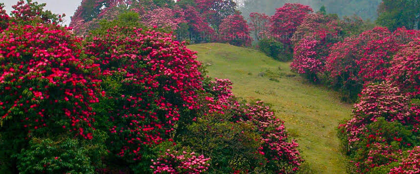
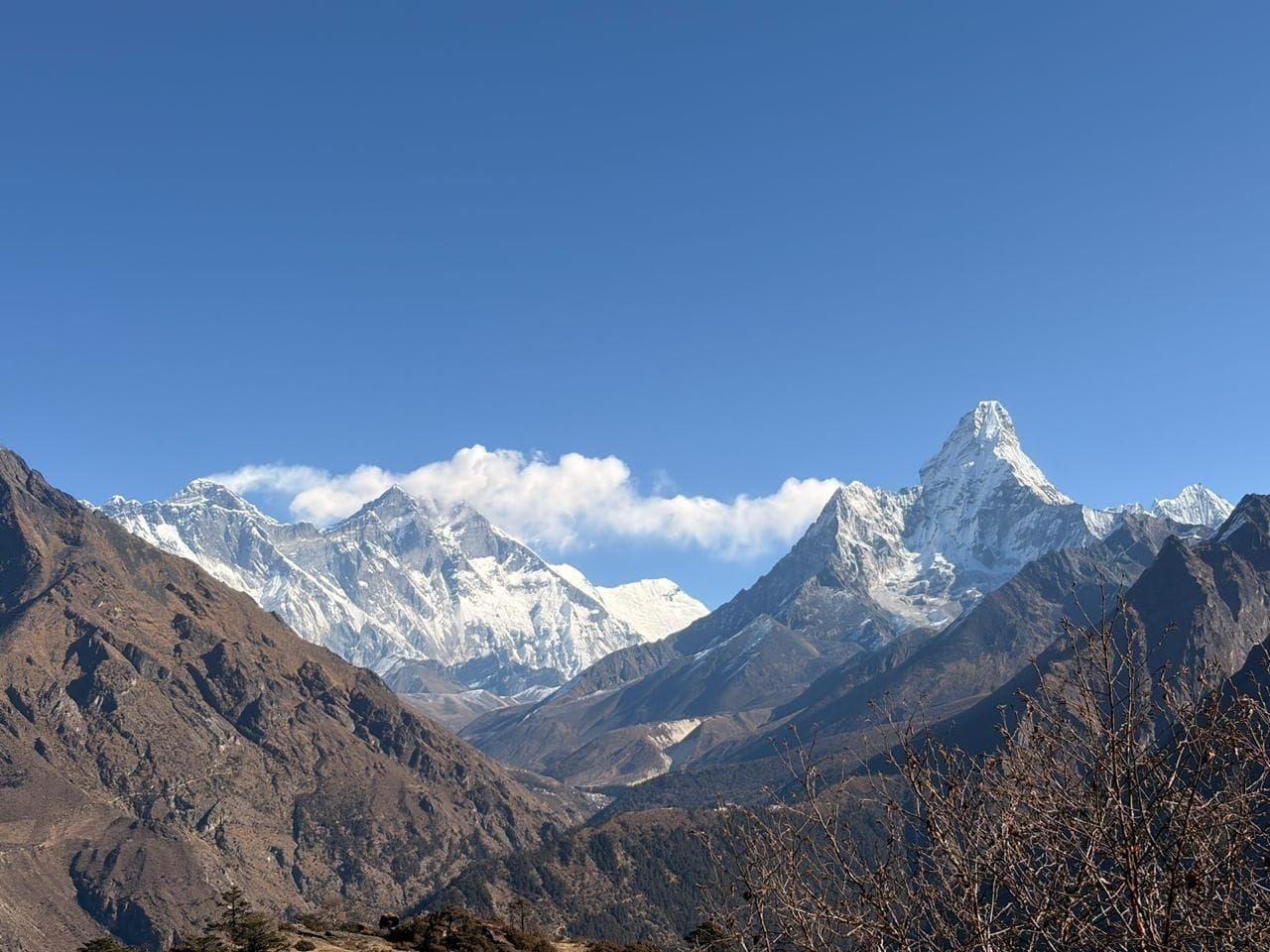
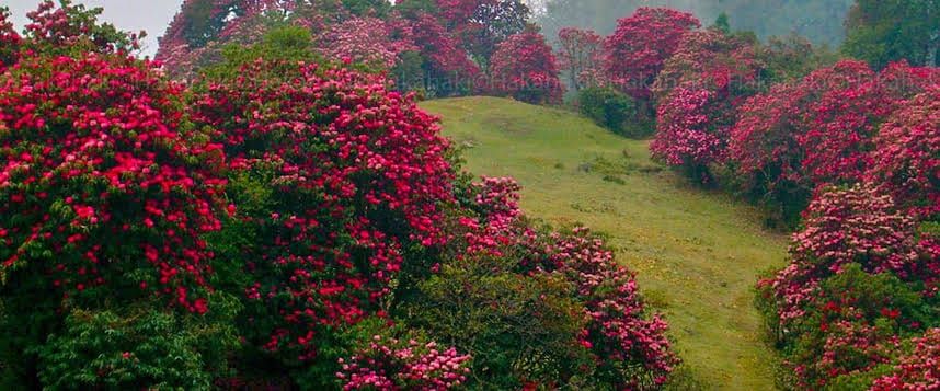
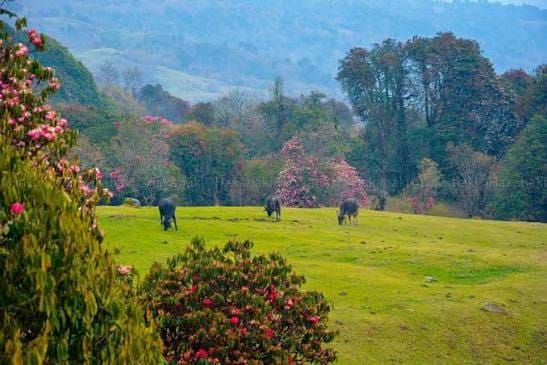
Walk high ridgelines between Tehrathum, Sankhuwasabha, and Taplejung, with Gupha Pokhari, Limbu settlements, and wide views toward Kanchenjunga and Makalu.
The journey offers space to notice how the landscape changes, eat what is seasonal, and let local knowledge shape the day. The point is not to collect sights. It is to understand why this place feels different from Nepal’s familiar routes.
Use local lodges and avoid picking rhododendrons or medicinal plants.
Complete planning guide
Planning Tinjure–Milke–Jaljale: itinerary, logistics, weather, and costs
Research-based framework, last reviewed 14 July 2026. Operational details — roads, flights, lodges, permits, fees — change; items marked for verification must be reconfirmed before booking.
Recommended6 days5–7 days from Kathmandu; 4 core destination days
Start / endKathmandu → Basantapur roadhead → Kathmandu (or exit via Chainpur/Tumlingtar)
Highest pointMilke Danda ridgeline, approximately 3,400 m
Trip stylenature escapeReasonably fit walkers comfortable with basic lodges and long road days; no technical terrain on the main ridge route.
A ridge journey through what is often called Nepal's rhododendron capital, walking the Tinjure–Milke ridgeline between Tehrathum, Sankhuwasabha, and Taplejung with Gupha Pokhari as its centrepiece. The full Jaljale traverse beyond Gupha Pokhari is a camping objective; the lodge-based version described here is the realistic core.
Getting there: preferred and alternative routes
PreferredKathmandu → Hile/Basantapur
Road (tourist or local bus, or private jeep) · 10–14 hours, often split with an overnight in Dharan or Hile · overnight: Hile or Basantapur
- Works because
- No flight dependency; passes through the Koshi highway corridor
- Trade-off
- Long and tiring; hill road quality varies after rain
- Vulnerable to
- Monsoon landslides on the Dharan–Hile road
- Book
- Buses bookable days ahead; jeeps arranged in Dharan
- Reconfirm locally
- Current road condition beyond Hile and where vehicles can actually reach toward Tinjure
AlternativeKathmandu → Bhadrapur (fly), then road via Ilam–Phidim
Flight plus 6–9 hours road
- Works because
- Cuts the longest road day roughly in half
- Trade-off
- Adds flight cost and weather dependency
- Vulnerable to
- Bhadrapur flights delay in monsoon and winter fog
- Book
- Book flights 1–2 weeks ahead in season
- Reconfirm locally
- Jeep availability from Birtamod/Phidim toward Basantapur
No flight, road, bridge, or lodge on this page is promised to operate on a given day — that is Nepal, honestly stated. Build the margins this page recommends.
Day by day
Day 1Kathmandu → Hile → Basantapur10–14 hours by road
Morning: Early departure from Kathmandu on the east–west highway toward Dharan.
Route and pace: A long road day; the climb from Dharan to Hile is slow but scenic tea-and-cardamom country.
The experience: The transition from Tarai heat to cool eastern hills, with Hile's bazaar a worthwhile leg-stretch.
Overnight and meals: Simple hotel or lodge in Basantapur; dal bhat dinner.
Key risk / decision: Road fatigue and delays — do not plan any walking today.
Fallback: Overnight in Dharan or Hile if the road runs late; start the trek a half-day later.
Day 2Basantapur → Tinjure Danda4–6 hours walking · approx. 2,900 m
Morning: Leave the roadhead through cultivated slopes onto the ridge trail.
Route and pace: Steady ridge climbing on a broad, well-used trail; no technical ground.
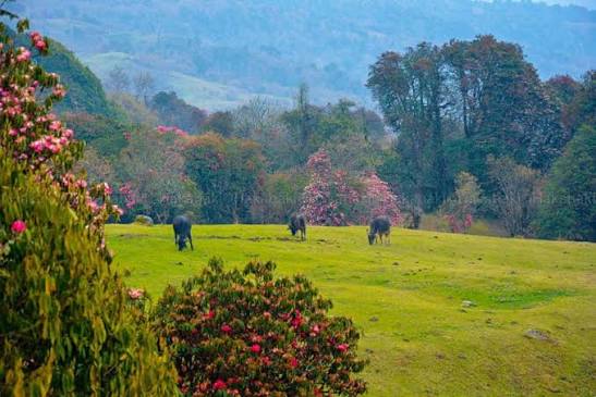
The experience: First rhododendron forest and, in clear weather, a widening panorama toward Kanchenjunga and Makalu.
Overnight and meals: Basic community lodge on or near the Tinjure ridge; simple set meals.
Water: Carry from Basantapur; ridge sources are seasonal — treat everything.
Key risk / decision: Afternoon cloud is normal; cold wind on the exposed ridge.
Fallback: Shorten to a lodge below the ridge crest if weather closes in.
Day 3Tinjure Danda → Chauki4–6 hours walking
Morning: Sunrise viewpoint before breakfast if skies allow.
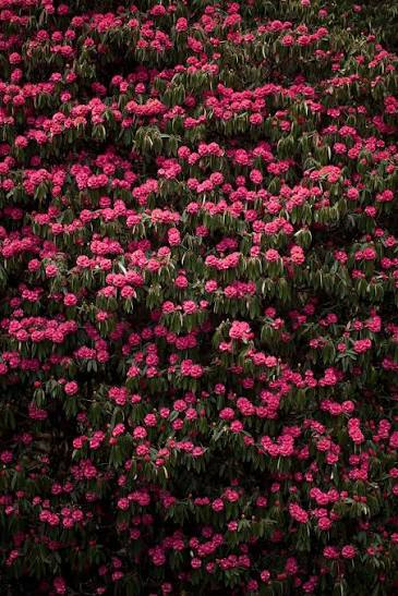
Route and pace: Undulating ridgeline walking through some of the densest rhododendron forest in Nepal.
The experience: In March–April the bloom is the point; in autumn it is the long clean views and quiet trail.
Overnight and meals: Lodge at Chauki or the best current settlement option; confirm with your guide which lodges are open.
Key risk / decision: Trail junctions on the ridge are unsigned — easy to drift onto herder paths.
Fallback: A local guide keeps the route honest; turn back to the last lodge if visibility drops badly.
Day 4Chauki → Gupha Pokhari5–7 hours walking · approx. 2,900 m
Morning: Continue north along the ridge with Milke Danda ahead.
Route and pace: Longer stages between settlements; a lunch stop at a seasonal teahouse if open.
The experience: Gupha Pokhari's sacred lake and its Limbu and hill-community surroundings — the cultural heart of the route.
Overnight and meals: Lodge at Gupha Pokhari; the settlement has the route's best facilities.
Water: Refill and treat at settlements; the lake itself is sacred — do not wash or swim.
Key risk / decision: Weather exposure on the highest ridgeline sections.
Fallback: Vehicle tracks reach Gupha Pokhari; a jeep exit is usually possible if someone needs out.
Day 5Milke ridge exploration → descend toward Basantapur or Chainpur side5–7 hours walking
Morning: Walk north onto the Milke Danda ridge for the best Kanchenjunga–Makalu panorama of the trip, then return to Gupha Pokhari or begin descending.
Route and pace: Out-and-back ridge walking at whatever pace the weather rewards.
The experience: The Jaljale lake country beyond is a camping expedition — enjoy the ridge edge of it and understand why the full traverse needs more support.
Overnight and meals: Lodge at Gupha Pokhari or descend partway toward the roadhead.
Key risk / decision: Do not push toward Jaljale without camping equipment and a guide who knows the water points.
Fallback: A rest-and-culture day at Gupha Pokhari is a legitimate alternative in poor weather.
Day 6Roadhead → Kathmandu (or Bhadrapur)10–14 hours by road
Morning: Jeep or bus from Basantapur, or from the Chainpur side if exiting toward Tumlingtar.
Route and pace: A long descent-and-highway day; build in slack for connections.
The experience: Hill bazaars and the return to the lowlands.
Overnight and meals: Kathmandu, or Bhadrapur if flying next morning.
Key risk / decision: Tight same-day international connections are a mistake after this road.
Fallback: Overnight in Dharan and continue the next day.
Weather through the year
| Season | Typical character | Trails, roads, lodges, flights | Think twice if |
|---|
| Mar–May | The rhododendron bloom (typically March–April, varying by year and elevation) with mild days, cold ridge nights, and building afternoon cloud and showers. | Trails good; roads generally passable; lodges open for the season. | You need guaranteed long views — spring haze and cloud are common by mid-morning. |
| Jun–Aug | Full monsoon: warm, very wet, leech-rich forest, and rare views. | Landslide risk on access roads; ridge trails muddy; some lodges close. | Almost everyone — this is a poor season for the route. |
| Sep–Nov | Post-monsoon clarity with the year's most reliable Kanchenjunga and Makalu panoramas; progressively colder nights. | Best trail and road conditions; lodges open. | Few reasons to avoid; book early around festival weeks when domestic travel peaks. |
| Dec–Feb | Cold and mostly dry; frost and occasional snow on the high ridge, excellent visibility on clear days. | Trails open but icy patches possible; some lodges reduce service. | Anyone unprepared for sub-zero ridge nights in basic lodges. |
Seasonal patterns, not forecasts. Temperatures vary dramatically with altitude on the same day — pack by elevation range.
Things to do
- Ridge walking through Nepal's largest rhododendron forests
- Gupha Pokhari sacred lake and its tea shops
- Sunrise panoramas toward Kanchenjunga and Makalu
- Limbu and hill-community village life
- Birdwatching in cloud forest, including seasonal migrants
On the ground
Accommodation
Basic community lodges and teahouses along the ridge, with the widest choice at Gupha Pokhari. Rooms are simple and unheated; bedding exists but a sleeping bag adds comfort and hygiene margin.
Food and water
Dal bhat, noodles, eggs, and seasonal vegetables; menus shrink between settlements. Treat all water; ridge sources are seasonal and shared with livestock.
Connectivity and power
Patchy mobile signal on the ridge (NTC generally better than Ncell in the east); charging at lodges is limited and sometimes paid. Carry a power bank.
Cash and payments
Cash only beyond Hile. Carry the whole trek budget in NPR from Dharan or Kathmandu, in small denominations.
Permits and guide requirements
| Requirement | Amount | Authority | Note |
|---|
| TIMS registration | Verify current fee and applicability | Nepal Tourism Board | Requirements for this non-park eastern ridge route have varied; confirm whether TIMS applies before departure. |
| Local municipality fees | Verify locally | Rural municipalities en route | Small local tourism fees are sometimes collected at roadheads or lodges. |
Guide requirement: Not a restricted area, but a local guide is strongly recommended: ridge junctions are unsigned, lodge status changes seasonally, and guiding fees keep value in trailside communities. Verify the current national guide rule for independent trekkers before planning to walk alone.
What it costs
| Band | USD (per person) | NPR (approx.) | What it buys |
|---|
| Budget local-service | USD 350–450 | NPR 54,000–NPR 69,000 | Bus access, local guide, community lodges — legitimate here because the route is unrestricted. |
| Recommended guided | USD 450–650 | NPR 69,000–NPR 100,000 | Private jeep segments, guide, and porter support. |
Main cost drivers
- Long road access from Kathmandu
- Local guide and any porter support
- Basic lodge and meal costs
Typically included
- Ground transport from Kathmandu
- Guide
- Lodge accommodation and meals on the ridge
Not included
- International airfare, visa, insurance
- Kathmandu hotels
- Tips, drinks, personal gear
Contingency: Add 10–15% for road delays and weather days.
Planning ranges per adult, twin-share, for the recommended duration from the stated gateway — not quotes. NPR conversion uses the Nepal Rastra Bank selling rate of USD 1 = NPR 153.3 reviewed 31 August 2026, rounded to the nearest NPR 1,000; bank, card, and cash rates differ. Excludes international airfare, visa, insurance, tips, and personal spending unless stated.
Packing essentials for this route
- Sleeping bag (comfort to around −5 °C in autumn/winter)
- Waterproof shell year-round; the eastern hills are wetter than central Nepal
- Water treatment
- Power bank and headlamp
- Leech socks in and around the monsoon
Safety and contingency
- The ridge reaches ~3,400 m — altitude illness is unlikely but cold exposure is real; carry proper layers.
- Evacuation from the ridge means walking or a jeep from Gupha Pokhari; travel insurance should cover trekking.
- Treat all water.
- Monsoon brings leeches and landslide-prone roads — timing matters more than fitness here.
If things change: Build one flexible day: the most common disruptions are road delays on arrival and a weather-blanked viewpoint day worth repeating.
Accessibility
Not suitable for travellers with significant mobility limitations: long rough road access and sustained ridge walking on uneven trails. The road-served Gupha Pokhari visit (jeep-based, minimal walking) is the gentler alternative — verify current road condition first.
Travelling responsibly here
- Do not pick rhododendrons or medicinal plants; the forest is the destination.
- Use community lodges and local guides so spending stays in Tehrathum and Sankhuwasabha.
- Carry out all non-organic waste; ridge settlements have no disposal.
- Ask before photographing people, shrines, and the sacred lake.
Booking checklist
- Confirm current road status beyond Hile and to Basantapur
- Engage a local guide via a registered agency or community contact
- Verify TIMS applicability for the route
- Check lodge status at Chauki and on Milke ridge for your dates
- Carry full cash budget from Dharan
- Reconfirm return transport the day before exiting
Sources
Research draws on the following, alongside NepalPick’s editorial method. Last reviewed 14 July 2026; recheck official sources on the day you book.