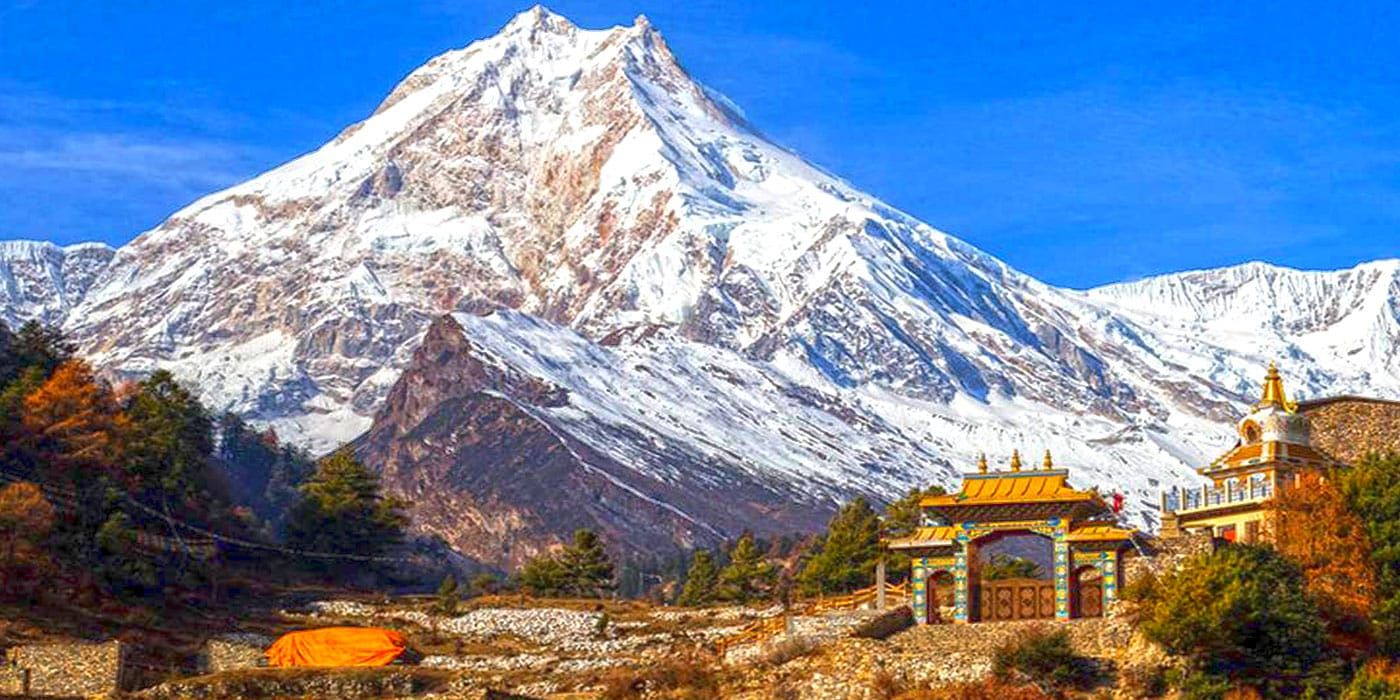
Why NepalPick recommends it
Why Limi Valley rewards curiosity
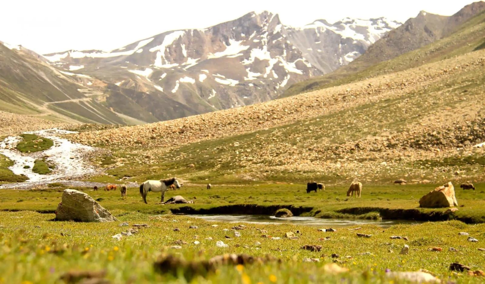
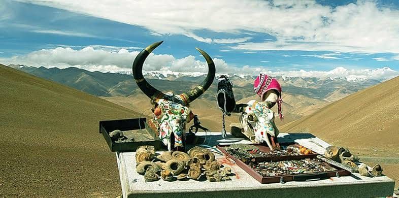
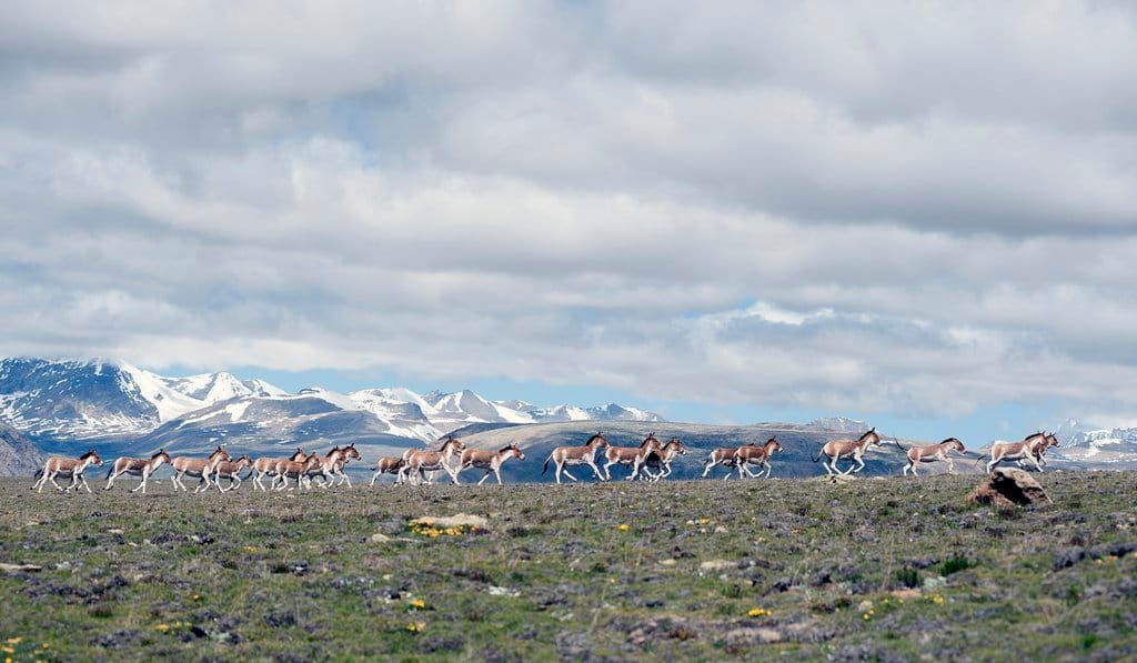
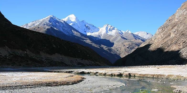
A remote circuit of Tibetan Buddhist villages, stark plateaus, monasteries, and ancient trade routes near Nepal’s northwestern frontier.
The journey offers space to notice how the landscape changes, eat what is seasonal, and let local knowledge shape the day. The point is not to collect sights. It is to understand why this place feels different from Nepal’s familiar routes.
Restricted area travel requires permits, a registered guide, and robust high altitude planning.
Complete planning guide
Planning Limi Valley: itinerary, logistics, weather, and costs
Research-based framework, last reviewed 14 July 2026. Operational details — roads, flights, lodges, permits, fees — change; items marked for verification must be reconfirmed before booking.
Recommended20 days18–23 days with at least three contingency days — flights, passes, and rivers all demand them
Start / endKathmandu → Nepalgunj → Simikot (fly) → Limi villages → Nyalu La circuit (conditions permitting) → Simikot
Highest pointNyalu La, approximately 4,940 m
Trip stylecamping expeditionSeasoned trekkers with altitude history and expedition patience: Humla is Nepal's remotest district and behaves like it.
The far-northwest's hidden circuit: up the Karnali's gorge arteries from Simikot into Limi — Halji, Til, and Jang, Tibetan Buddhist villages of the old Purang trade world, with Halji's 1,000-year-old Rinchenling gompa as anchor — returning over the Nyalu La's high desert when the pass allows. Nepal's emptiest legal wilderness, carrying its own rules.
Getting there: preferred and alternative routes
PreferredKathmandu → Nepalgunj → Simikot
Two flights (overnight Nepalgunj) · Day 1 + morning Day 2 · overnight: Nepalgunj
- Works because
- The only realistic access
- Trade-off
- Simikot is Nepal's most cancellation-prone hub of consequence
- Vulnerable to
- Weather rules the strip; monsoon halves reliability
- Book
- 3–4 weeks; agencies hold blocks
- Reconfirm locally
- Flight-day patterns for your window and cargo/baggage reality
AlternativeOut-and-back valley route (no Nyalu La)
Walking · Saves 2–3 days and the pass risk
- Works because
- The honest plan B — keeps every village, drops the crux
- Trade-off
- Retraces the gorge
- Vulnerable to
- Low by comparison
- Book
- —
- Reconfirm locally
- Decide at Jang with your guide, conditions in hand
No flight, road, bridge, or lodge on this page is promised to operate on a given day — that is Nepal, honestly stated. Build the margins this page recommends.
Day by day
Day 1Kathmandu → Nepalgunj1-hour flight
Morning: Stage west; expedition kit-check.
Route and pace: —
The experience: The ritual antechamber night.
Overnight and meals: Nepalgunj.
Key risk / decision: —
Fallback: —
Day 2Nepalgunj → Simikot45-min flight · approx. 2,950 m
Morning: The dawn slot over ranked ridgelines to Humla's shelf capital.
Route and pace: Arrival admin: permits registered, staff mustered, loads sorted.
The experience: Simikot's end-of-Nepal energy.
Overnight and meals: Lodge, Simikot.
Key risk / decision: You are already at altitude — treat arrival day gently.
Fallback: Flight-cancellation buffers begin their work.
Day 3Simikot → Dharapori5–6 hours walking · approx. 2,300 m
Morning: Over the first shoulder and down to the Karnali's artery.
Route and pace: A descending first stage — deceptive; the river gorge sets its own terms.
The experience: The Karnali: Nepal's longest river in its adolescent gorge.
Overnight and meals: Village camp/basic lodge.
Water: Treat throughout the route.
Key risk / decision: Mule-train trail etiquette — mountain-side, always.
Fallback: —
Day 4Dharapori → Kermi4–5 hours walking · approx. 2,700 m
Morning: Upriver through walnut and barley terraces.
Route and pace: Warm gorge walking with hot springs above Kermi as reward.
The experience: First gompas; Humli village life along the old salt route.
Overnight and meals: Camp/homestay, Kermi.
Key risk / decision: —
Fallback: —
Day 5Kermi → Yalbang5–6 hours walking · approx. 3,020 m
Morning: Gorge benches and pine spurs.
Route and pace: Steady; altitude accumulating politely.
The experience: Namkha Khyung Dzong — Yalbang's substantial working monastery; evening prayers if welcomed.
Overnight and meals: Camp/monastery-adjacent lodge.
Key risk / decision: —
Fallback: —
Day 6Yalbang → Tumkot5–6 hours walking · approx. 3,380 m
Morning: The gorge narrowing toward its Tibetan inflection.
Route and pace: Trail blasted into rock in stretches — attention sections.
The experience: Dhungkar Choezom gompa above Tumkot; the culture shifting registers northward.
Overnight and meals: Camp, Tumkot.
Key risk / decision: Exposed trail stretches; poles and spacing.
Fallback: —
Day 7Tumkot → Yari / Thado Dunga5–6 hours walking · approx. 3,700–3,900 m
Morning: Out of the gorge world into high, dry borderland benches.
Route and pace: Altitude-led; the road-track to Hilsa intrudes in places — walk its margins.
The experience: Trans-Himalayan light; the Tibetan plateau's breath arriving.
Overnight and meals: High camp, Yari side.
Key risk / decision: Sleeping altitude jumps — assess the group tonight.
Fallback: Split the stage; margin exists.
Day 8Over Nara La → Hilsa6–7 hours walking · pass approx. 4,620 m; Hilsa approx. 3,720 m
Morning: The first pass: prayer-flagged Nara La with Tibet's hills filling the north.
Route and pace: Slow up, long scree down to the border river.
The experience: Hilsa's strange border energy — the Kailash gateway settlement.
Overnight and meals: Basic lodge/camp, Hilsa.
Water: Carry over the pass.
Key risk / decision: Pass weather; border-zone discipline — cameras away near facilities.
Fallback: Camp below the pass and split if needed.
Day 9Hilsa → Manepeme → toward Til6–7 hours walking · approx. 3,900–4,000 m
Morning: Contour the Karnali's western wall into Limi proper.
Route and pace: Ledgy, remote, unforgettable.
The experience: Entering the valley the world forgot to modernise.
Overnight and meals: Camp near Manepeme/Til approach.
Key risk / decision: The route's most isolated stretch begins — sat-comm check-ins.
Fallback: —
Day 10Til village3–5 hours walking · approx. 4,000 m
Morning: Short stage to the first Limi village.
Route and pace: Deliberately short — altitude and arrival courtesy.
The experience: Til's amphitheatre of stone houses and its small gompa; fields at the edge of the possible.
Overnight and meals: Village camp (arranged); homestay where offered.
Key risk / decision: —
Fallback: —
Day 11Til → Halji4–5 hours walking · approx. 3,740 m
Morning: Down-valley along Limi's river plain.
Route and pace: Gentle; the valley opens its main street.
The experience: Halji and Rinchenling gompa — a millennium of continuous practice; the circuit's cultural summit.
Overnight and meals: Camp/community stay, Halji.
Key risk / decision: —
Fallback: —
Day 12Halji rest + gompa dayLight
Morning: Rinchenling with permission and patience; village life alongside.
Route and pace: The itinerary's deliberate hold.
The experience: Why you came: butter lamps, murals, and a living Purang-world community.
Overnight and meals: Halji.
Key risk / decision: Glacial-lake flood history shadows the village — your guide knows the story and the escape lines.
Fallback: —
Day 13Halji → Jang4–5 hours walking · approx. 3,930 m
Morning: The last village stage east.
Route and pace: Easy valley walking.
The experience: Jang's fields and the valley's closing walls — decision ground for the pass.
Overnight and meals: Camp, Jang.
Key risk / decision: Tonight is the Nyalu go/no-go: snow, wind, group state.
Fallback: The out-and-back turns here, with honour intact.
Day 14Jang → Talung high camp5–6 hours walking · approx. 4,300–4,600 m
Morning: Climb out of habitation into the lake-and-moraine shelf below Nyalu.
Route and pace: Expedition-slow.
The experience: Tshom Tso's high lakes; the emptiest camp of the route.
Overnight and meals: High camp.
Water: Sources sparse — plan with the crew.
Key risk / decision: Committed ground now; weather calls are absolute.
Fallback: Retreat to Jang remains open until it isn't — hence the early starts.
Day 15Nyalu La → descend toward Sallikhola/Chumsa7–9 hours walking · pass approx. 4,940 m
Morning: The crux: a long high crossing with Saipal's massif commanding the south.
Route and pace: Alpine start, steady rhythm, long descent.
The experience: The route's summit-feeling day — Humla entire beneath you.
Overnight and meals: Camp below on the Sallikhola side.
Key risk / decision: Snow closes this pass outside its windows; there is no arguing with it.
Fallback: Full retreat via the valley — pre-agreed, pre-budgeted.
Day 16Descend the Chumsa drainage5–7 hours walking · to approx. 3,000 m
Morning: Down through juniper and pine toward the Karnali confluence world.
Route and pace: Long descent; knees on notice.
The experience: Oxygen and birdsong returning by the hour.
Overnight and meals: Camp/village stay, lower drainage.
Key risk / decision: Descent fatigue.
Fallback: —
Day 17→ Kermi/Dharapori corridor5–6 hours walking
Morning: Rejoin the Karnali artery southbound.
Route and pace: Familiar trail, opposite light.
The experience: Hot springs above Kermi as the circuit's bath-house finale.
Overnight and meals: Kermi/Dharapori.
Key risk / decision: —
Fallback: —
Day 18→ Simikot5–6 hours walking
Morning: The final climb back to the shelf.
Route and pace: One last honest ascent.
The experience: Simikot's bazaar as returning metropolis.
Overnight and meals: Simikot lodge; flight positioned.
Key risk / decision: —
Fallback: —
Day 19Simikot → Nepalgunj → KathmanduTwo flights
Morning: Dawn slot off the shelf.
Route and pace: —
The experience: Humla releasing you in one long window-seat farewell.
Overnight and meals: Kathmandu.
Key risk / decision: The route's most cancellation-prone strip — buffers exist for this.
Fallback: Day 20 (and honestly, plan 21–23).
Day 20Contingency day (of three recommended)—
Morning: Unassigned.
Route and pace: —
The experience: Flights, pass-waits, or river-crossing delays — something will claim it.
Overnight and meals: —
Key risk / decision: —
Fallback: Book 21–23 days total where schedules allow.
Weather through the year
| Season | Typical character | Trails, roads, lodges, flights | Think twice if |
|---|
| Mar–May | Late winter high: Nyalu usually still loaded early spring; gorge stages workable from April. | Flights fair; pass windows unreliable before late May. | Circuit ambitions before June. |
| Jun–Aug | The paradox window: rain shadow keeps Limi walkable while Nepalgunj–Simikot flights take monsoon punishment. | Trails good high, flights bad low; rivers run big. | Anyone without deep schedule flexibility — yet this is the circuit's classic season. |
| Sep–Nov | Stable and cold; Nyalu's best late-September–October window before snow returns. | Best flight odds; villages harvesting. | Late-November pass hopes. |
| Dec–Feb | Humla winter: pass shut, villages inward, severe cold. | Not a season for the circuit. | Everyone. |
Seasonal patterns, not forecasts. Temperatures vary dramatically with altitude on the same day — pack by elevation range.
Things to do
- Halji's Rinchenling gompa — a functioning millennium
- Til and Jang's stone-village worlds
- Nyalu La and the Tshom Tso lake shelf
- Nara La and Hilsa's border-gate strangeness
- Yalbang's working monastery
- Kermi hot springs
- The Karnali gorge arteries of the old salt trade
On the ground
Accommodation
Camping expedition with village-adjacent camps and occasional homestay/lodge nights (Simikot, Kermi, Hilsa). Limi's villages host by arrangement — your agency's relationships are the accommodation plan.
Food and water
Expedition catering with village supplements (tsampa, butter tea, seasonal potatoes). Resupply is Simikot or nothing. Treat all water.
Connectivity and power
Simikot has intermittent service; the circuit effectively none. Satellite communication mandatory; solar-panel power planning with the crew.
Cash and payments
All cash from Nepalgunj; village payments and staff needs in small notes.
Permits and guide requirements
| Requirement | Amount | Authority | Note |
|---|
| Humla Restricted Area Permit | USD 50 per person per week, then USD 10/day (official baseline as of 14 July 2026 — recheck) | Department of Immigration via registered agency | Covers the designated Humla wards including Limi — verify your route's exact ward coverage when issued. |
| Local/conservation fees | Verify current applicability | Local government / DNPWC | Municipal fees have been reported in the corridor; your agency confirms the current set. |
Guide requirement: Registered agency, licensed guide, and support crew mandatory — restricted area, expedition terrain. Staff altitude equipment and insurance are audit items, not assumptions; monastery access runs entirely on your guide's relationships and conduct.
What it costs
| Band | USD (per person) | NPR (approx.) | What it buys |
|---|
| Recommended expedition | USD 2,400–3,400 | NPR 368,000–NPR 521,000 | Group-shared full support: flights, permits, staff, catering, camps. |
| Small-party / premium | USD 3,400–4,200 | NPR 521,000–NPR 644,000 | Low ratios, generous buffers, best equipment. |
Main cost drivers
- Humla permit
- Four highly weather-exposed flight sectors
- Full camping staff for three weeks
- Contingency days as real budget
Typically included
- Flights
- Permits
- Full camping infrastructure, staff, and meals
- Village-stay arrangements
Not included
- International airfare, visa, expedition-rated insurance to 5,000 m
- Personal high-altitude kit
- Tips at expedition scale
- Delay costs beyond planned buffers
Contingency: 20–25%. No independent band exists — legally or practically.
Planning ranges per adult, twin-share, for the recommended duration from the stated gateway — not quotes. NPR conversion uses the Nepal Rastra Bank selling rate of USD 1 = NPR 153.3 reviewed 31 August 2026, rounded to the nearest NPR 1,000; bank, card, and cash rates differ. Excludes international airfare, visa, insurance, tips, and personal spending unless stated.
Packing essentials for this route
- −20 °C-comfort sleeping system
- Full four-season shell and down
- Microspikes shoulder-season
- Water treatment redundancy
- Sat-comm schedule agreed with home
- Border-zone documentation discipline: passport + permit copies distributed through the kit
Safety and contingency
- Ascend conservatively: once above 3,000 m, keep sleeping-elevation gains modest and build in acclimatisation days as scheduled.
- Learn the symptoms of acute mountain sickness before departure and agree turnaround rules with your guide — descent is the treatment.
- Helicopter evacuation depends on weather, daylight, and insurance; carry insurance that explicitly covers your maximum altitude and confirm the emergency process with your operator.
- Treat all drinking water; carry a filter or purification tablets rather than relying on bottled supply.
- Two 4,600 m+ passes with camps between: this is the collection's most sustained altitude commitment after Kanchenjunga.
- River crossings in the shoulder drainage run with the melt — morning crossings, crew judgement.
- The border zone demands documentation discipline and camera sense.
- Evacuation is flight-dependent from Simikot — margins scale accordingly.
If things change: Three days minimum, and 21–23 total where possible. The out-and-back (no Nyalu) is the built-in honourable abbreviation; the full retreat down-valley the deeper one. Decide thresholds before departure, on paper.
Accessibility
Not accessible. Humla's circuit is the collection's remotest undertaking.
Travelling responsibly here
- Monasteries here are living institutions predating tourism by centuries: permission, silence, donations without display.
- Photograph people, homes, and rituals only with clear consent — Limi's privacy is part of its survival.
- Expedition-grade leave-no-trace including human-waste management.
- Hire Humli staff and buy village supplies at asked prices — the trade route's new economy is you, behaving well.
- Kailash is visible from legal Nepali ground in places; do not let the view tempt border foolishness.
Booking checklist
- Agency with genuine recent Humla/Limi departures
- Permit ward-coverage verified against the route
- Flight blocks with rebooking priority both ends
- Staff insurance/equipment audited in writing
- Sat-comm and evacuation protocol agreed
- Expedition insurance to 5,000 m
- Cash staged at Nepalgunj; three-week budget real
Sources
Research draws on the following, alongside NepalPick’s editorial method. Last reviewed 14 July 2026; recheck official sources on the day you book.